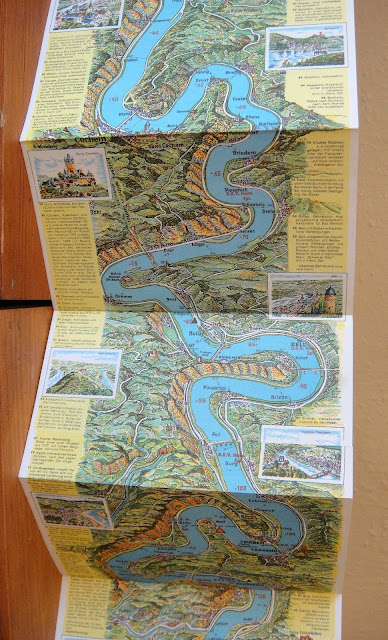
It's only very recently that I came across a whole new genre of accordion publications called "strip maps." This rather unique form of cartographic representation has been around for quite a long time, as early as 2000 B.C. The panoramic feature of the accordion format is clearly well-suited to mapping things like the Great Wall of China or the Berlin wall, but strip maps are more traditionally associated with travel. This example illustrates one popular type, the strip map of a river.
If you are interested in going deeper into the fascinating world of strips maps, this great article by Alan M. MacEachren titled A Linear View of the World: Strip Maps as a Unique Form of Cartographic Representation (1986), is the place to start: download
12 single-sided pages, individually 6.25" x 3.75" and when fully opened 3' 9".
The accordion strip map open at the first page


No comments:
Post a Comment